PhotoGeo Trip Down East: Part 2
Maybe it’s the Three Day Rule. Or perhaps it’s being in the boreal north, up on the Canadian Shield. Either way, I’ve noticed a marked improvement in the photo ops we been having over the last few days.
The Three Day Rule relates to a person’s need for three days in a new place to establish a new routine and begin feeling comfortable again. It’s a phenomenon that has been noticed in a variety of situations, including NASA space voyages and with regular people like you and me while travelling.
Dan and I are now five days in and, although we’ve moved twice, more of a routine is developing.
Add to that the bliss of being in the boreal north, and all is right with the world.
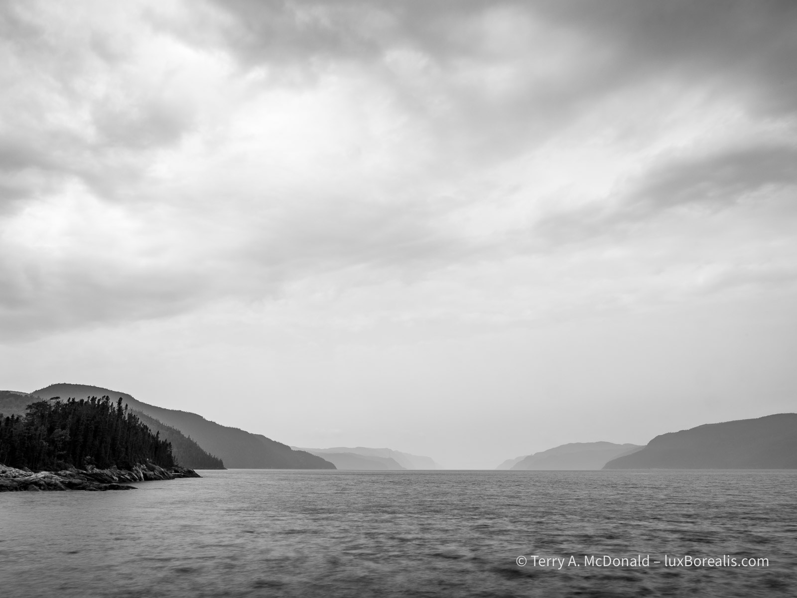
Parc national du Fjord-du-Saguenay
The honk of the Ravens, the sweetly singing White-throated Sparrow—Oh Sweet Canada, Canada, Canada—the rocky rivers and pristine lakes, the deranged drainage patterns, bunches of bunchberry, and the rugged hills forested with black spruce and balsam fir—to me, these all speak of a peacefulness I can never find in southern Ontario.
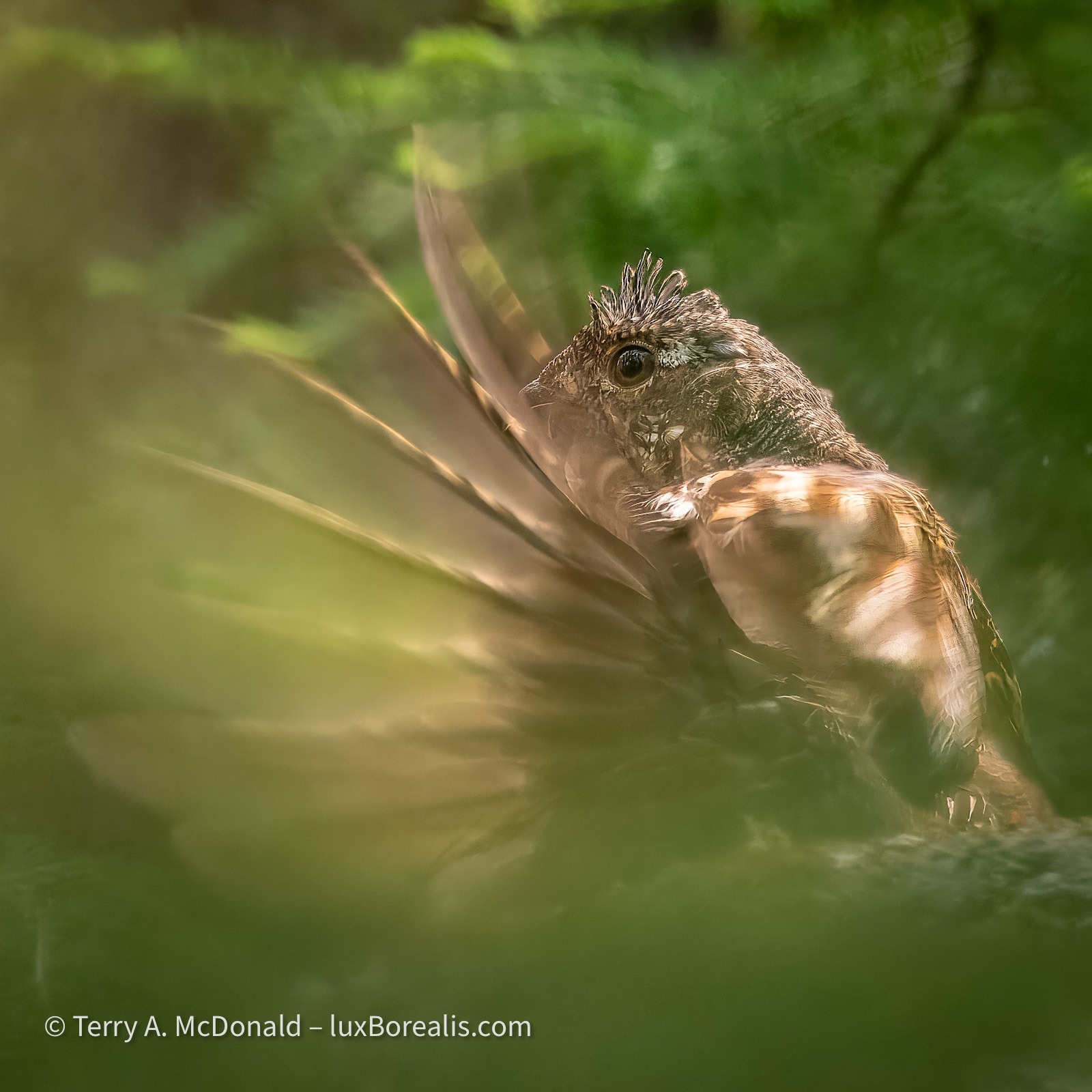
Today it was the thrumming of a Ruffed Grouse, echoing through the forest; his attempt to attracting a mate with his rapid wing beats.
OM-1 w/ M.Zuiko 100-400mm ƒ5-6.3 at 400mm; ƒ8 @ 1/160, ISO 200, POL; raw file processed in Lightroom and Topaz PhotoAI for improved sharpening around the head and better definition in the feathers.
A polarizer filter is an essential tool in nature photography for reducing the glare from foliage and water. However, for a shot like this, I would typically remove it, but in the heat of the action I had forgotten it was on from photographing the cliffs of the fjord.
Nineteen—that’s the cost of this Ruffed Grouse photo. Nineteen black fly bites—and that’s just on my arms! Oh, and that’s with Muskol on, too. I’m glad I changed into long pants.
After the first thrum—so close we could feel it. Dan pointed upwards into the bush. The grouse was on a rocky outcrop about 2 metres above us and about 8 metres into the thick of the forest. The next 30 minutes were spent looking for a window through the branches and needles, carefully moving one foot then the other so as not to alarm him.
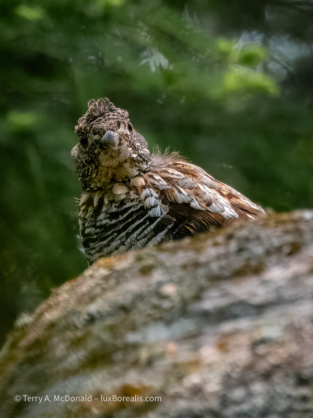
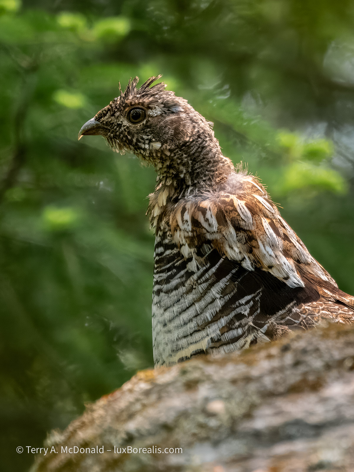
Ruffed Grouse (Bonasa umbellus), Male, Parc national du Fjord-du-Saguenay.
OM-1 w/ 100-400mm at 400mm (800mm efov); ƒ8 @ 1/250, ISO 6400; raw file processed in Lightroom.
Our stealth paid off. Periodically he would drum, starting slowly, thruuuuump, thruuuuump, thruuump—then gradually picking up speed to a a crescendo of wing beats. I could hear David Attenborough in my head describing “the mating ritual of the ruffed grouse”!
I would love to say that catching the movement of the wings was planned, but in reality, it was the limitations of light that gave me what turned out to be the ideal shutter speed to catch the wing movement.
OM-1 w/ 100-400mm at 400mm (800mm efov); ƒ8 @ 1/4000, ISO 800; raw file processed in Lightroom
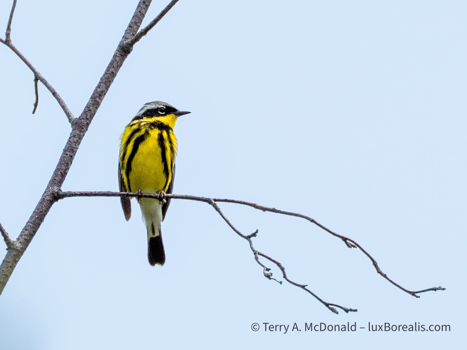
What was supposed to be a 10-minute trail to three viewpoints over the cliffs of the fjord turned into an hour and a half of birding and photography. The magnolia warbler was incessant in its singing, moving from branch to branch, then to the massive hydro-electric pylon which, in itself is impressive, carrying cables across the 1500m width of the fjord.
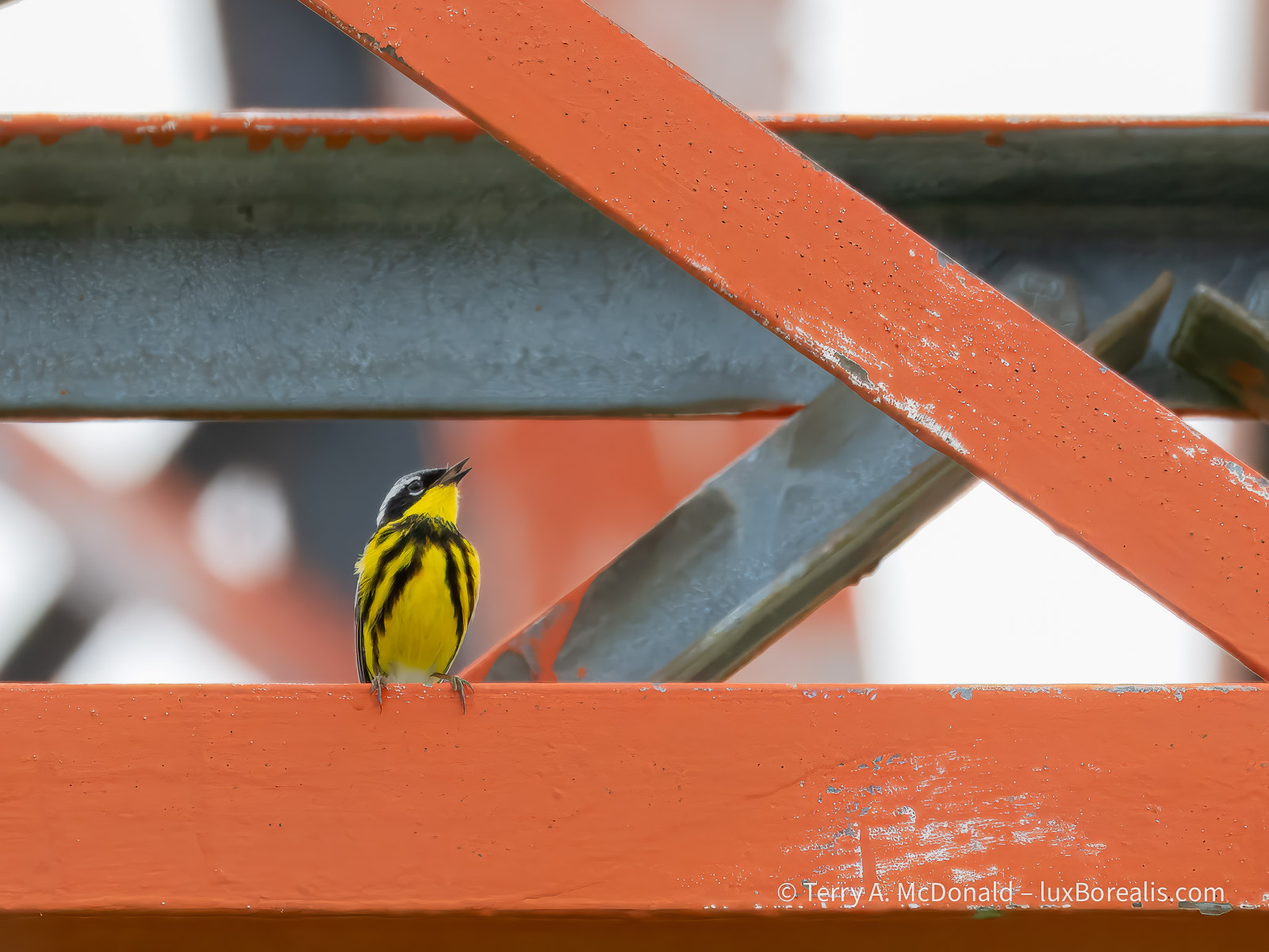
OM-1 w/ 100-400mm at 400mm (800mm efov); ƒ8 @ 1/800, ISO 800; raw file processed in Lightroom and Topaz PhotoAI.
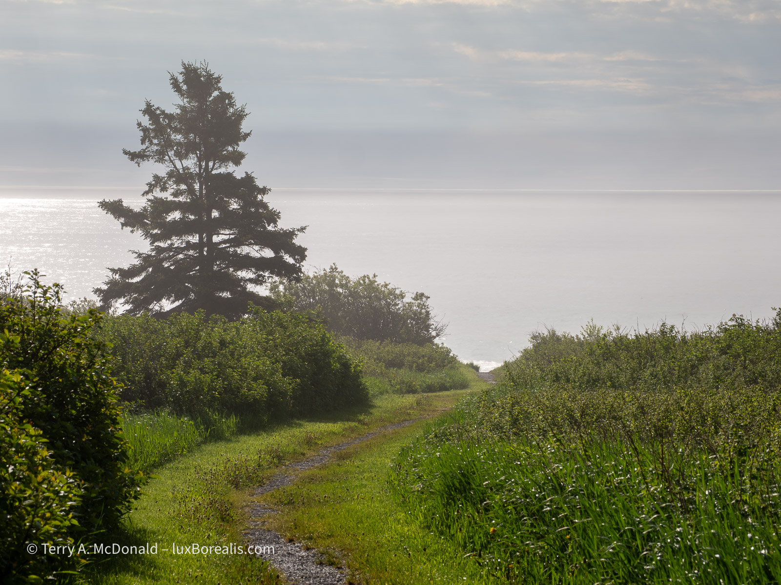
Earlier in the morning we walked up and down the gravel road outside our accommodations at L’Anse-Saint-Jean, birding and photographing. The bird song was constant.
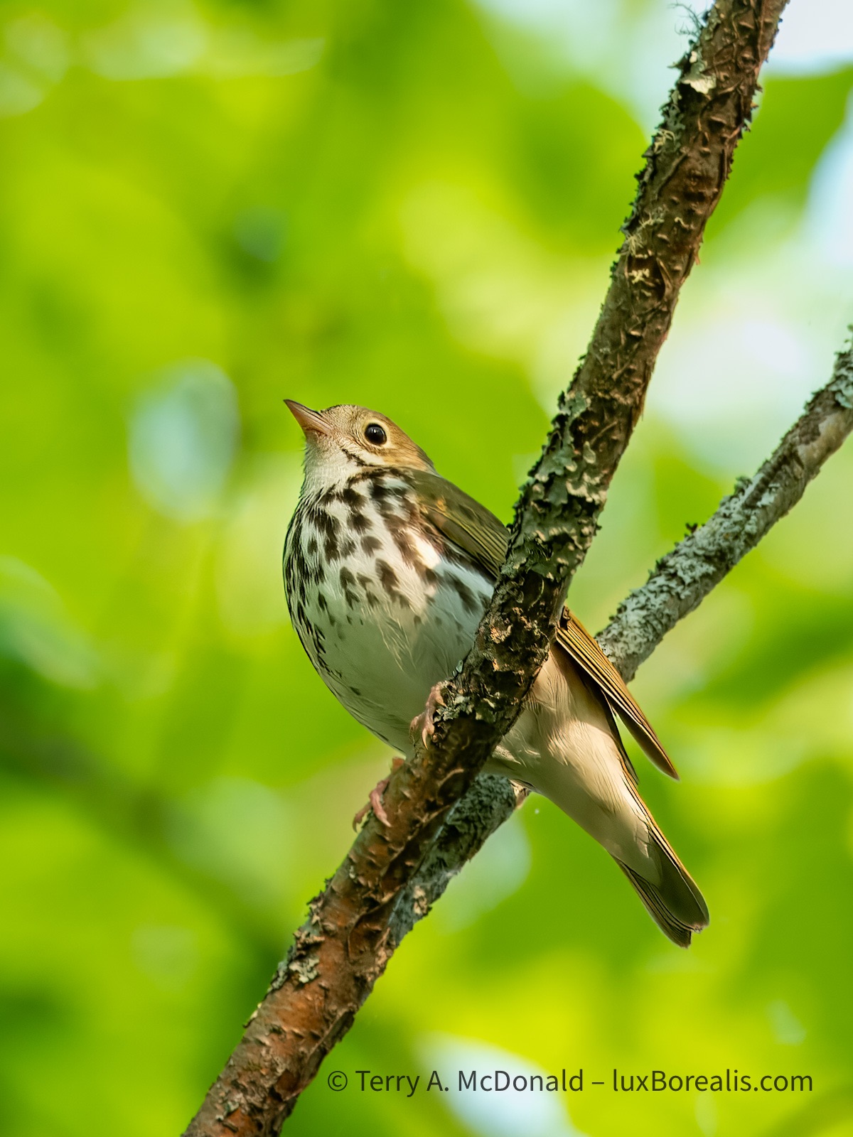
Given the shutter speed used to capture this, I am ever thankful for the excellent IBIS in the OM-1. Just a light sharpening in Topaz brought this image back to usefulness.
OM-1 w/100-400mm at 400mm (800mm efov); ƒ8 @ 1/50, ISO 800; raw file processed in Lightroom and Topaz Photo AI.
One of my favourite photos of the trip is this simple one of a fern in the forest, backlit by the morning sun. I used Focus Stacking to achieve full depth of field.
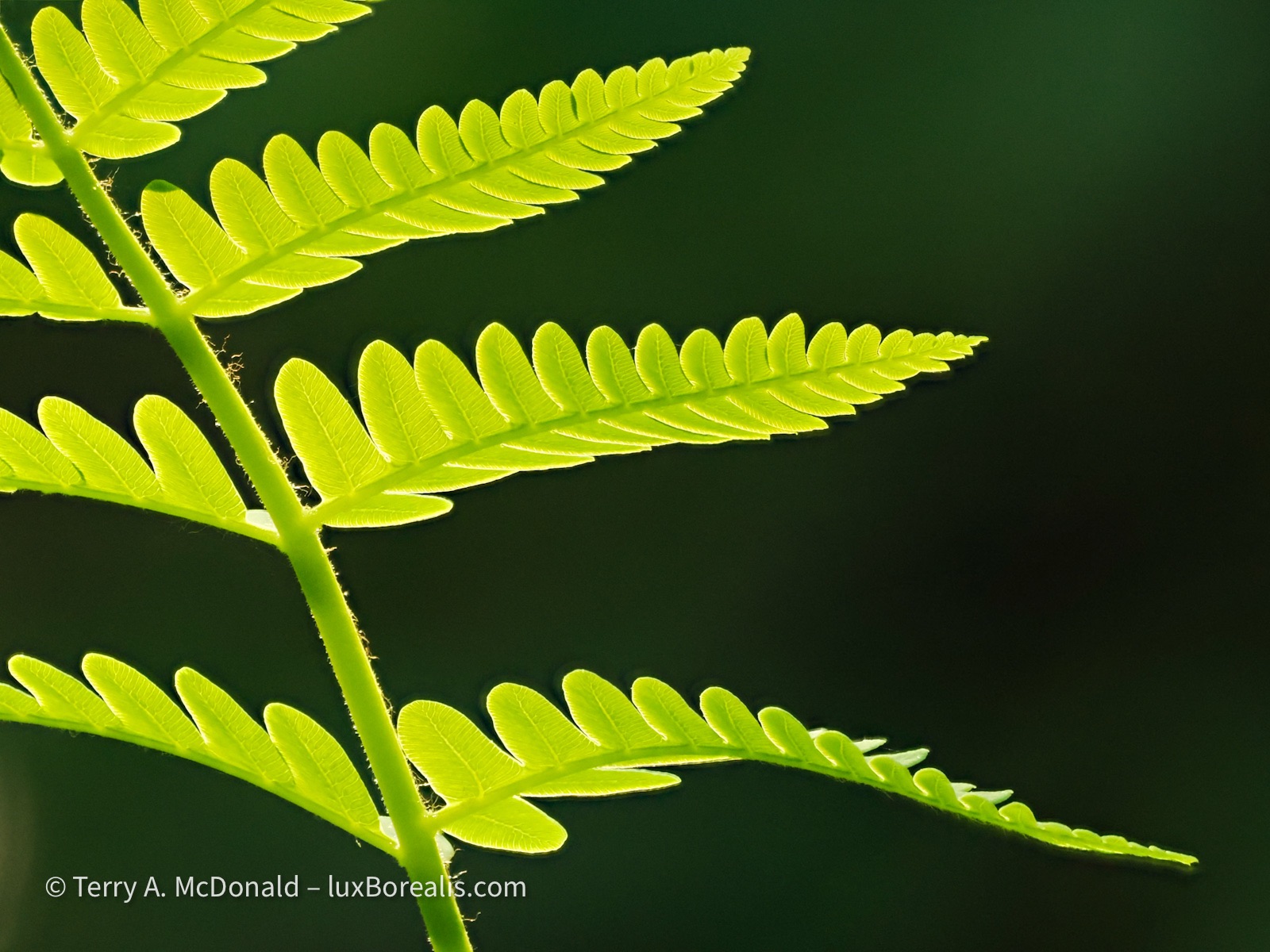
OM-1 w/ 100-400 at 400mm (800mm efov); ƒ8 @ 1/500, ISO 3200; Focus Stack of 8 images; raw file processed in Lightroom.
The only editing done on this was to increase the ‘Whites’ by 50 to better accentuate the rim lighting on each leaflet.
At 105km, the Saguenay Fjord is the 5th longest in the world and one of very few that empties into an estuary and not directly into the ocean—and it is staggeringly beautiful. While not as narrow and picturesque as many Norwegian and Greenlandic fjords, its cliffs plunge some 200 to 300m in sheer drops to the water. Given clear weather and not the milky skies we had, I would be publishing more than just these two.
OM-1 w/12-100mm at 17mm (34mm efov); ƒ14 @ 2sec., ISO 200; LiveND64; raw file processed in Lightroom.
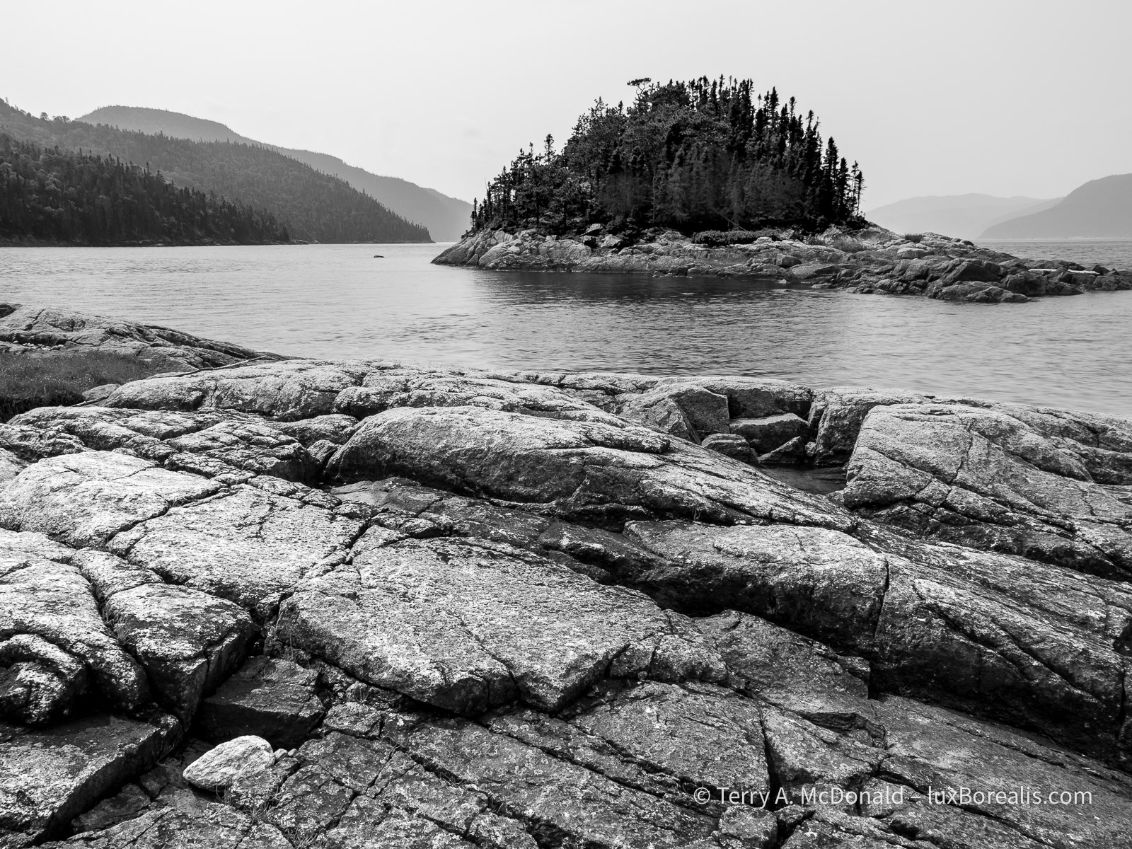
OM-1 w/ 12-100mm at 12mm (24mm efov); ƒ8 @ 1/100, ISO 200, POL; raw file processed in Lightroom. Foreground is always important in landscapes. Having survived millennia of erosiona nd repeated glaciation, this ancient, tortured, fractured rock was ideal.
However, there are some stunningly beautiful, rocky rivers running through the park and on the way to and from the Saguenay that are definitely worth a stop.
This first one, came out of nowhere. As Dan and I zipped along the highway, we caught a glimpse of what appeared to be a dilapidated bridge—stopped and went back. In fact, it’s a ski-doo trail bridge, where we spent 30 to 45 minutes, pondering and photographing, crossing the bridge and back again, looking for just the right perspective. At first, I was baffled about how to capture this unique statement of the winter culture, but gradually I began to see this image.
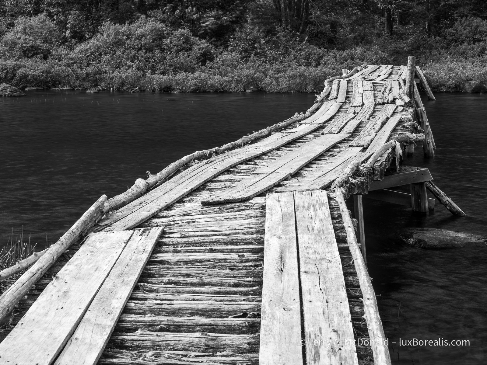
OM-1 w/ 12-100mm at 28mm (56mm efov); ƒ8 @ 1/320, ISO 800, POL, HHHR; raw file processed in Lightroom.
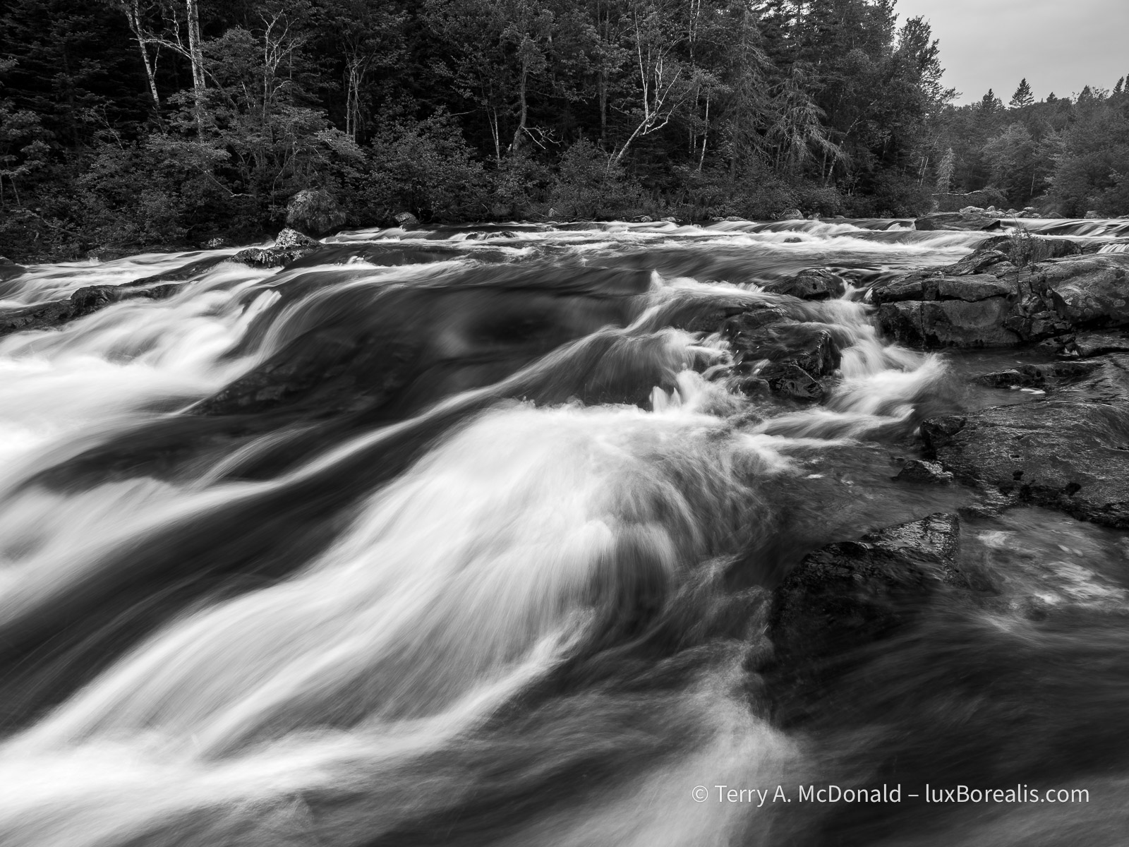
I photographed this scene in two ways: (1) using HHHR to slightly blur the river; and (2) using the normal 20MP setting which froze the river. I prefer the softer blurring of the river, which is the photograph presented here.
I’ll often do that—shoot both normal and HHHR. I’m finding the HHHR advantages of blurring moving water and added dynamic range to be very helpful. The blurring of the water has to be checked carefully: if the shutter speed is too high relative to the flow of water, then the flow can appear staggered or cut up, rather than smooth.
This second river photo was done along the highway between Saint-Simeon and the Saguenay. There were a number of stops we could have made, but, as was often the case, time was getting on.
OM-1 w/ 12-100mm at 12mm (24mm efov); ƒ9 @ 1/2sec, ISO 800, LiveND 64; raw file processed in Lightroom.
Just a note on place names: in Québec, provincial parks such as Saguenay Fjord are called ‘national parks’; not to be confused with National Parks of Canada, such as . . .
Forillon National Park
It’s 5:30am, the beginning of day 8. Sunrise was at 4:14am, with the dawn chorus beginning sometime before that. Being in a tent, the soundscape was pleasurably overwhelming. I’d love to say I’ve been out shooting, but with an overcast sky, I decided to stay at our campsite, make coffee, and do some writing.
OM-1 w/ 12-100mm at 54mm (108mm efov); ƒ8 @ 1/1000, ISO 100, HHHR; raw file processed in Lightroom.
I’m finding the HHHR files to be wonderful for raising shadow areas without introducing noise—far better than shooting the same image as an HDR, which also seems to mute the colours somewhat.
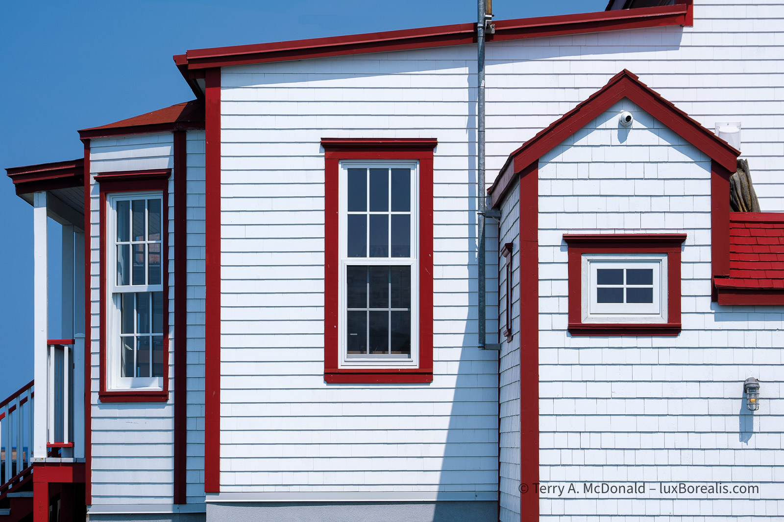
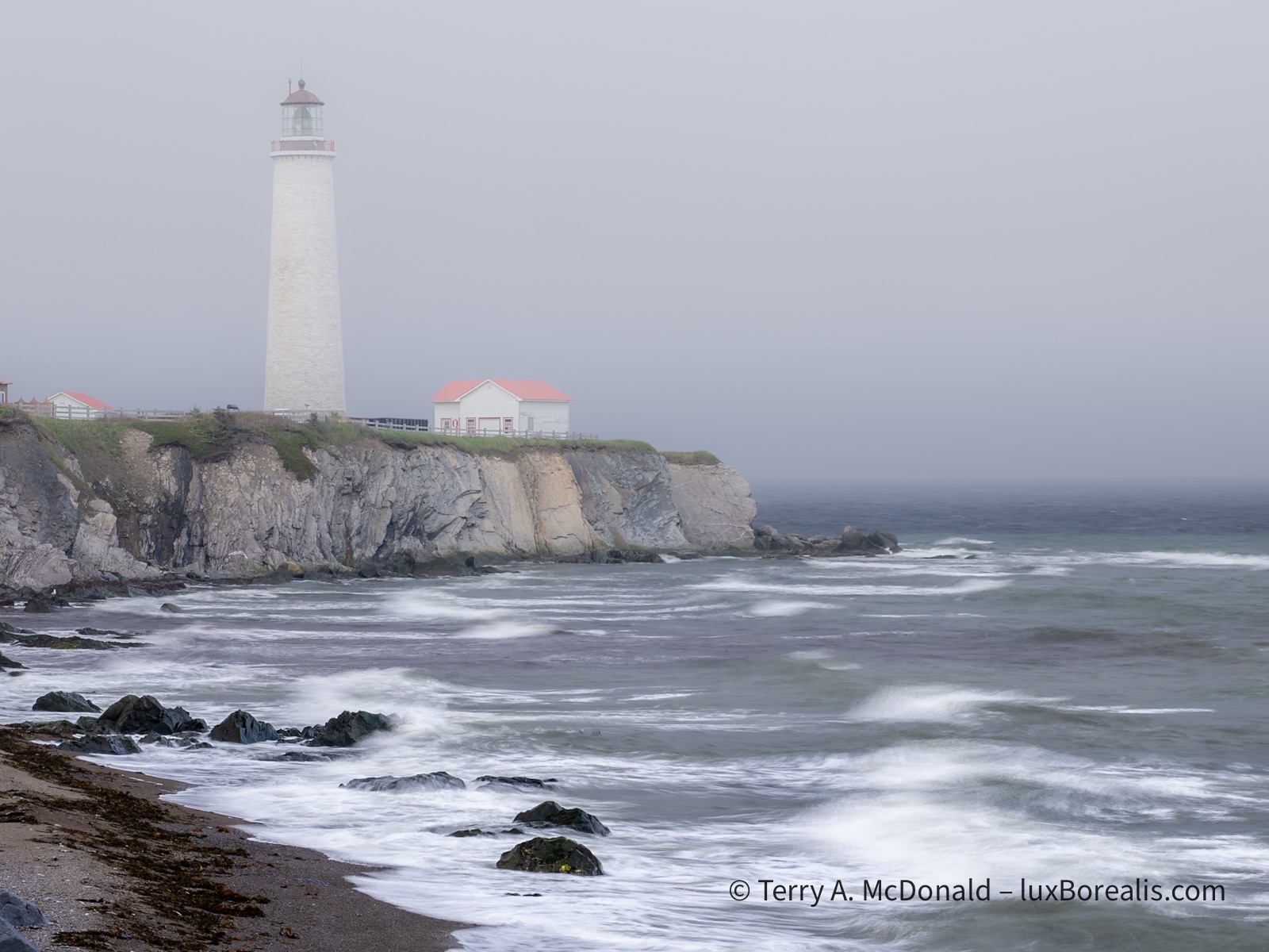
Forillon is a long drive from Saguenay—8 hours including the ferry. We crossed the St. Lawrence by ferry from Saint-Simeon to Rivière-du-Loup and continued on down the St. Lawrence to Gaspé. What a beautiful drive. We would have liked to stop for some of the unique architecture and colourful homes, but time was against us. We did stop for a couple of lighthouses, though.
OM-1 w/ 12-100 at 75mm (150mm efov); ƒ5.6 @ 1/640, ISO 200, HHHR; raw file processed in Lightroom.
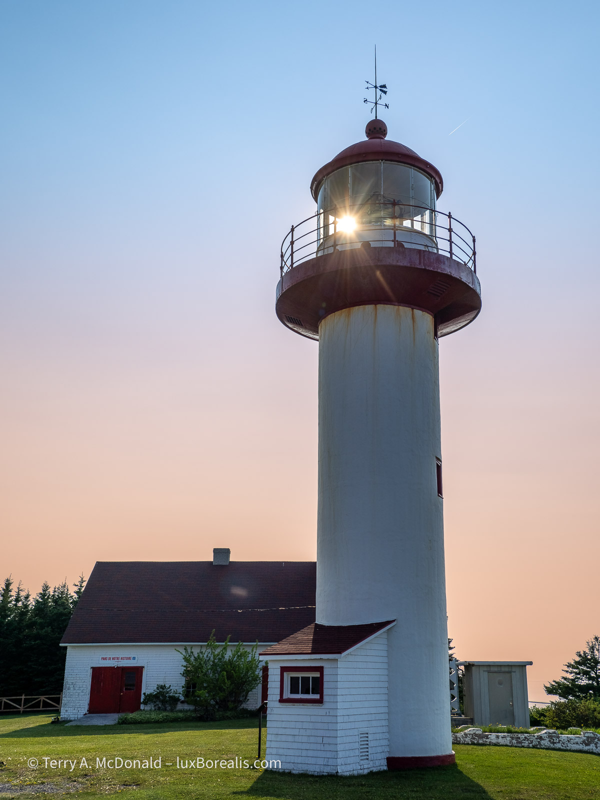
OM-1 w/ 12-100mm at 18mm (36mm efov); ƒ5.6 @ 1/3200, ISO 200, HHHR; raw file processed in Lightroom.
The cliffs along the St. Lawrence are dramatic. But then, scattered along the coast are small villages with some agriculture, where ever a river had made its way down to the what is now, essentially, open ocean. Photographically, nothing seemed to work out well, so you’ll have to take my word for it.
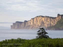
Forillon itself is just as stunning. It’s the northern end of the Appalachian Highlands on mainland North America. The rock captures two significant mountain-building events—the Taconic orogeny, 450mya and the Acadian orogeny, 380mya—showing clearly with great arcs and diagonals of rock strata. Once as high as the Rockies, perhaps even higher, we now see the eroded remains of those mountains as the Appalachians.

These are the spectacular cliffs on the north side of Forillon.
OM-1 w/ 12-100mm at 100mm (200mm efov); ƒ5.6 @ 1/250, ISO 200, HHHR; raw file processed in Lightroom.
The same cliffs as shown above also provide nesting sites for thousands of sea birds: herring gulls, razorbills, guillemots, etc.
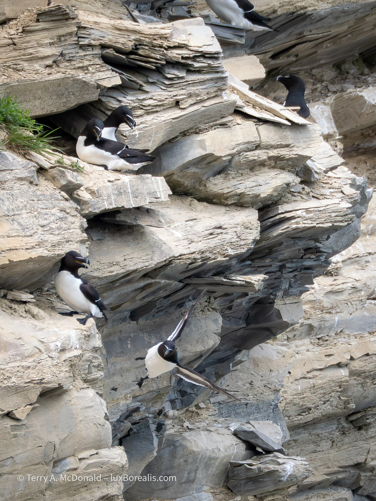
OM-1 w/100-400mm at 400mm (800mm efov); ƒ8 @ 1/1600, ISO 1600; raw file processed in Lightroom.
While photographing the death defying heights and flights, we were witness to a dramatic nest-robbing event by crows. After a few minutes of tormenting a razorbill pair at their nest, a crow picked up one of the eggs and tried to make off with it. Sadly, it ended up broken, spilling the contents and the developing embryo down the cliff face. You can see the egg breaking open in the lower left of the photo.
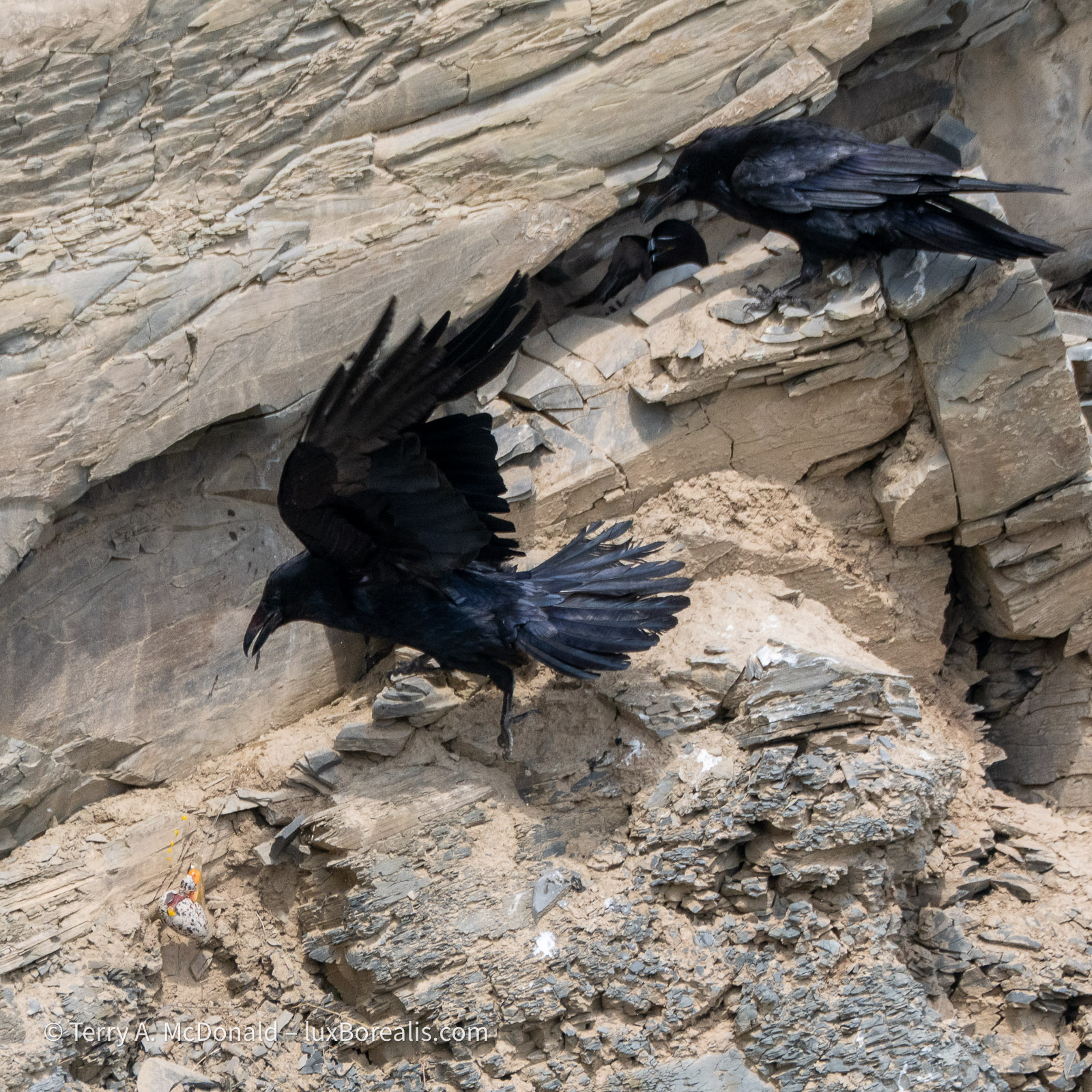
OM-1 w/ 100-400mm at 400mm (800mm efov); ƒ8 @ 1/1600, ISO 800; raw file processed in Lightroom.
In the afternoon, we took a wander down the ‘La Chute’ trail to see the waterfalls. Nice, but not overwhelming. Finally, I had an opportunity to use my tripod and TripodHR mode, providing an 80MP file. Often, tripods are not conducive to travel photography, as you are always on the go. I could have—and should have!—used it with the Riviére Noire photo above, but was being lazy. Those set-ups really deserved to be captured as 80MP files!
The rock strata in the area is diagonal, resulting from the uplift of the Appalachians, so my goal in photographing the falls was to preserve those diagonals in the flow of water.
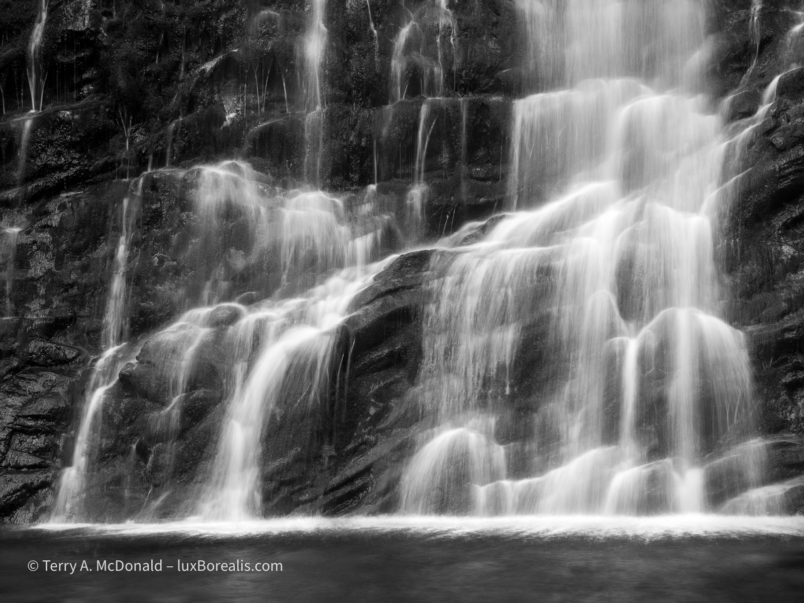
OM-1 w/ 12-100mm at 38mm (76mm efov); ƒ8 @ 1/10, ISO 100; TripodHR; raw file processed in Lightroom.
I promised myself earlier this year to make better use of a tripod, so I really must live up to that promise. I’m not sure Kouchibouguac National Park will offer the same opportunities, but I know for sure Mahone Bay, and after that Cape Breton Highlands National Park should offer some good coastal opportunities.
With a grey overcast and flat light, I must admit to not feeling creatively inspired for much of the rest of the day. I’m one who is drawn to the light, often looking for a subject to best take advantage of the light. So, when it turns dreary, I just don’t ’see’ much worth photographing.
OM-1 w/ 12-100mm at 50mm 9100mm efov); ƒ8 @ 1/50, ISO 100, HHHR; raw file processed in Lightroom.
As we drove back to Forillon from having a fish ‘n’ chips and poutine dinner, we became inundated by a low-hanging fog. I specifically used HHHR at a slow shutter speed to blur the waves while capturing a larger file size. Setting the ISO to 100 allowed for 1/50th rather than 1/100th providing a more even blur.
For now, it’s getting late and here in the far east of the Eastern Time Zone, the sun is rising awfully early, so I’ll turn in. Tomorrow is another long day of driving to Kouchibouguac National Park.
Thanks for reading! Be sure to leave a COMMENT, whether it’s a question about equipment, techniques or locations or just an observation to add to the discussion.
Discover more from luxBorealis Blog
Subscribe to get the latest posts sent to your email.

WOW, just WOW! Great bird encounters.
I loved all your photos in this blog! I think my favourite is the Razorbills, but I do like the Dilapidated bridge also.